Search This Blog

Showing posts with label wildflower. Show all posts

Wednesday, 29 January 2014

HASSAN’S WALLS LITHGOW WESTERN BLUE MOUNTAINS

HASSAN’S WALLS LITHGOW 
WESTERN BLUE MOUNTAINS

Anyone driving on the Great Western Highway between Hartley and Lithgow will have noticed the cliffs of Hassan’s Walls above them. They are outliers of the same Triassic sandstone familiar to everyone in the western Blue Mountains.
Like Govett of Govett’s Leap at Blackheath, people ask “Who was Hassan?” Answers will vary: he was an escaped convict (there was a convict stockade below the Walls in the early days), he was a character in the Arabian Nights, he was an Arab stockman.
The right answer seems to be that Governor Lachlan Macquarie named the Walls during his trip to Bathurst in 1815 on the newly built Cox’s Road. It is said that they reminded him of the Walls of Hassan in southern India, but whether this is true or not I cannot say. However the name came to be given, it has certainly stuck.                                                                                                                               
1895 newspaper quote
The Walls have always been a tourist attraction to visitors and the people of Lithgow. The area was made a Reserve as long ago as 1895; however it was the work of James Padley during World War 1 that laid the foundation for the Reserve as we see it today. Even a brief look at Trove (newspaper files) reveals the extent of the problems – vandalism, littering, stealing native plants
Illustrated Sydney News February 7th 1889
and just general apathy. Nor have these problems ceased in the district. The Zig Zag Railway has been suffering from constant vandalism and theft for years, most likely carried out by local residents, perhaps the descendants of the Hassan’s Walls vandals of earlier years.
Lithgow City Council is in the process of having a boardwalk, interpretive signs etc constructed right now (January 2014). No doubt these will be great assets and improve the visitor’s experience greatly. However, history shows that the graffiti “artists”, vandals and thieves won’t take long to get up there to try to spoil that experience.
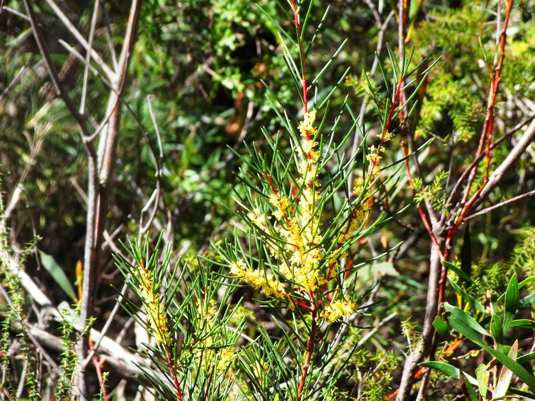
The area has an incredibly varied fauna which includes plants scarcely known elsewhere. Please protect this environment – no rubbish, keep to made tracks and the boardwalk and definitely no fires!                                                         

Something needs to be said about the prominent rock outlier so noticeable during the drive around the “Forty Bends” at Old Bowenfels. Right at the end of a ridge, you can hardly miss the likeness to a man’s head. I’ve been aware of it for as long as I can remember. The old name for this erosional feature is “King George’s Head”, though I have heard it called “Indian’s Head” locally as well. Let’s stick to the traditional name.
So why King George’s Head? The king referred to is undoubtedly George III and the only likeness most people in Australia would have seen of the king was on his coinage. He faces right on his coins, as does the rock when seen from the Highway (which rules out Georges II and IV who face left on their coins). The best known image of King George (who reigned from 1760 to 1820) is on the celebrated "cartwheel penny” of 1797, which circulated widely in the colony. I believe this is the origin of the name.
NOTE ADDED 11th November 2017.The 1806 penny, especially a worn example (which was the usual condition of Australian circulating coins) is more likely to have been in the pockets of people in those days. They remained in circulation right up to the gold rush days.
You will find a fascinating account of Lithgow in this article from the Illustrated Sydney News February 7th 1889) from which the pictures above come. The article also mentions King George’s Head. Click here.
A good article about the development of the Reserve in James Padley’s time may be found here.
You will find my video here and another (Holiday Hunter) here
NOTE ADDED 28th March 2015 - report from the Lithgow Mercury on a recent landslide here.


Friday, 3 January 2014

THE BRAESIDE WALK, BLACKHEATH BLUE MOUNTAINS NSW AUSTRALIA

THE BRAESIDE WALK, BLACKHEATH 

BLUE MOUNTAINS NSW AUSTRALIA

This beautiful walk is not one with a long pedigree, no mention being made of it in any publication I can find before 1946. It is shown on a map of 1935 as “Walk to Govett’s Leap”. 

There are several possible access points: (a) from Govett’s Leap Lookout, by taking the Cliff Top walk down to the crossing over Govett’s Leap Brook, where the northern end of the track begins. (b) by following the power line tracks from near Connaught Rd and Cleopatra St. and (c) from James Rd, which is a gravel road leaving Braeside St near Bell St. going through to Evan’s Lookout Rd. This crosses Govett’s Leap Brook just above the old railway dam; the southern access to the track is nearby. A parking area and a small picnic area are located here, making it the simplest access point to the walk, which basically follows the creek down to the brink of Govett’s Leap. James Rd, however, is often regarded as a 4 wheel drive road.

Govett's Leap Brook crossing
Braeside is an appropriate name, meaning approximately “the bank of a creek”. The name of the street is identical to several older cottages in Blackheath, none of which were actually in the present street of that name. Braeside St is the obvious source of the name of the walk and it appears to have been named before 1920.
Robinson's 1952 map

The original water supply for the railway (steam engines use lots of it) was drawn from swamps in what is now the Memorial Park. Two dams were subsequently constructed here; however they proved inadequate as railway traffic increased and a dam was built on Govett’s Leap Brook in 1906. From here, water was pumped up to a reservoir in Whitley Park then fed by gravity to the railway station. This system was abandoned in 1927. The dam wall and brick and stone foundations remain.

My video on the walk is here
Railway dam and picnic area

                                     https://johnsbluemountainsblog.blogspot.com/2013/12/links-to-all-blog-entries-and-relevant.html All Blue Mountains blogs and videos
Shoalhaven District Geology  
                           

Saturday, 23 November 2013

THE FAIRFAX HERITAGE TRACK, BLACKHEATH BLUE MOUNTAINS NSW AUSTRALIA

THE FAIRFAX HERITAGE TRACK, BLACKHEATH 

BLUE MOUNTAINS NSW AUSTRALIA


Family group about to commence the walk October 2004

On the track September 2013
The Fairfax Heritage Track was constructed in 1986/7 to provide an easily accessible pathway from the National Parks and Wildlife Heritage Centre to Govett’s Leap Lookout in Blackheath. It is identified as a wheelchair accessible route and this is indeed true, a rarity in Australian national parks. The only problem might be the return trip up the hill from the lookout, which is somewhat steeper and has a number of “humps” where drains pass underneath. It would be better for someone to walk back up and bring a vehicle down to the lookout.

Classic shelter shed July 2007
At George Phillips Lookout July 2009
The route is well signposted and passes through a variety of vegetation types, each clearly indicated. There are seats at regular intervals as well and this makes this simple walk a joy for any lover of the Australian bush.

Perhaps the highlight of the walk is George Phillips Lookout, where the path dramatically emerges from the bush onto one of the most spectacular views in the Blue Mountains. It’s only a few minutes walk from here to the Govett’s Leap Lookout car park where there always seems to be lots of visitors. I guess this spot is Blackheath’s equivalent to Echo Point at Katoomba, (without the parking fee). However I doubt if one in a hundred takes the track to George Phillips Lookout, which is great if you would like to just sit and enjoy the view in peace.

Photo courtesy of the Blue Mountains City Library
The original sign erected at George Phillips Lookout in 1946 had these words: “National Reserves. George Phillips Lookout. In appreciation of the able and energetic service of Ex-Alderman George Phillips, a pioneer of the district and active member & Secretary of the Blackheath Group of the Blue Mountains Sights Reserves from 1917-1939. Opened by the Blackheath Municipal Council 28-1-1946”. No doubt there are similar stories which could be told about all our Blue Mountains beauty spots but it is up to us to ensure they are recorded.

 For my video of the walk, click here.

Thursday, 10 October 2013

WALL'S CAVE AND THE UNDERGROUND RIVER, BLACKHEATH BLUE MOUNTAINS AUSTRALIA

WALL'S CAVE AND THE UNDERGROUND RIVER

BLACKHEATH BLUE MOUNTAINS AUSTRALIA

It’s a privilege to be able to visit this interesting spot in the Blue Mountains. For years access was not permitted because the place lies within the catchment area of Greave’s Creek Dam, which supplies water to towns within the Sydney Water region. In fact it is a short distance below another dam on the same creek. This explains the strict conditions imposed on those visiting the spot.
"Path to Wall's Cave" Kerry & Co.
Powerhouse Museum

 Quite apart from the beauty of the location, there is the added interest of the indigenous history of the Cave (actually a large sandstone overhang rather than a cave). You can read about this in “Blackheath Today From Yesterday” published by the Rotary Club of Blackheath, pages 143-144. If you can’t get hold of a copy of this fine book, go to this site   where you will find photographs by JC Merriman. Read especially the comments on geology and archaeology.
It would appear that the spot was discovered by a Mr Wall who actually owned the land at the time; this happened around 1892. As things turned out, access was easier from Medlow Bath in those days than from Blackheath, but today no other route is permitted than that specified by Sydney Water, which is to go to the end of Wall’s Cave Road Blackheath (off Evan’s Lookout Road) and then stay on the track down to the creek, returning the same way.  The image on the right is from the Evening News (Sydney) 21 December 1901 (courtesy of Trove).     I can remember visiting the place several times between 1950 and 1970, but whether we were there legally or not I don’t know. My uncle owned property nearby in the 50’s so we would have started from there.

I’m sure you will enjoy a visit to this special place. Allow an hour or so and obey all signage.

View my Blue Mountains videos on my YouTube site here . This includes a video on the Wall’s Cave and the Underground River, found here


Tuesday, 1 October 2013

PERRY’S LOOKDOWN, BLACKHEATH BLUE MOUNTAINS NEW SOUTH WALES AUSTRALIA

PERRY’S LOOKDOWN, BLACKHEATH 

BLUE MOUNTAINS NEW SOUTH WALES AUSTRALIA

Hat Hill Road at Blackheath leads out to several places where there are superb views over the valley of the Grose River and its tributaries. Among these is Perry’s Lookdown, a popular place with visitors since the 1880’s. There are three identified lookouts – Perry’s Lookdown itself, Docker’s Lookout and what has become known as Monument Lookout. Beyond the third lookout the track descends steeply into the valley, providing access to the Blue Gum Forest and the walking tracks which radiate from it.

You’ll enjoy reading an article from the Illustrated Sydney News (NSW: 1853 - 1872), Saturday 16 February 1884, page 14, 15 titled “Our Trip to Binda Caves” (now called Jenolan Caves) during which the party visited Perry’s Lookdown. Search the newspaper files at http://trove.nla.gov.au .                                                                 
Immediately opposite the main lookout is the dramatic Mt Banks, so named by George Caley in November 1804 in honour of his patron, Sir Joseph Banks, when his attempt to cross the Blue Mountains came to an end on the brink of those cliffs. See this reference here for more information about Caley’s expedition. The mountain is capped by a small area of basalt which has somewhat fortuitously preserved a remnant of the Hawkesbury Sandstone and a complete section of the underlying Narrabeen Group sediments of the Sydney Basin.
 
The National Parks and Wildlife Service has provided a rather scarce facility in the form of a small overnight camping area which is particularly useful for those doing the longer walks.
Monument Lookout is the site of memorial to a group of 4 teenagers who died in the vicinity in a bushfire in 1957. See the story in The Canberra Times (ACT : 1926 - 1995), Monday 2 December 1957, page 1.

View my Blue Mountains videos on my YouTube site here . This includes a video on the lookouts at Perry’s Lookdown here


Thursday, 26 September 2013

PAUL HARRIS LOOKOUT, BLACKHEATH BLUE MOUNTAINS NEW SOUTH WALES AUSTRALIA

PAUL HARRIS LOOKOUT, BLACKHEATH 
BLUE MOUNTAINS NEW SOUTH WALES AUSTRALIA

While this lookout lacks the grandeur of Govett’s Leap Lookout or Perry’s Lookdown, it has the advantage of being in a quiet location, with a pleasant view down Blackheath Glen and – sometimes the best of all – you will most likely have the place to yourself. The downside is that there are no toilets. Access is by going over the railway level crossing, turning left into Station Street and keeping straight ahead instead of going right to Shipley and Megalong Valley. It is located at the end of Staveley Parade, one of Blackheath’s earliest streets.The lookout was constructed in 1955 by the Blackheath Rotary Club, using funds bequeathed to the Club by Bill Tucker, one of its charter members. Tucker was much involved in community affairs, having served for some years on the Blackheath Municipal Council and especially with the local Horticultural Society.  The lookout is dedicated to the memory of Paul Percy Harris, who founded Rotary International in Chicago in 1905. The first Club in the Blue Mountains was formed in Katoomba in 1937. Blackheath followed in 1944.
Here is a link to a 1942 interview with Paul Harris on You Tube. The link to the video on Paul Harris Lookout is here .


Sunday, 8 September 2013

GORDON FALLS LOOKOUT AND ELYSIAN ROCK, LEURA BLUE MOUNTAINS NEW SOUTH WALES AUSTRALIA

GORDON FALLS LOOKOUT AND ELYSIAN ROCK, LEURA BLUE MOUNTAINS NEW SOUTH WALES AUSTRALIA

See the blog entry on Gordon Falls Reserve, which gives details of the origin of the reserve and also my You Tube videos on the area.For a good read, go to Trove (trove.nla.gov.au) and look up the story printed in “The Blue Mountain Echo” (NSW: 1909 - 1928) for Friday 18 April 1919. The author must have walked down to or close to the site of the present lookout to have been able to see the waterfall. The Lookout is easily reached from the parking area. Before getting even that far, you will pass an old painted sign on the left, on which the faint words “Fairy Dell” can just be discerned. The sign has gone now (June 2021).
This could refer to “Fairy Glen”, accessed by a track now out of use leading from the Lookout track. See the sample page from “Mountain Mist Books” here on how to locate this old track. On the other hand, the map shows Fairy Dell below the cliff line. Another good read from “The Blue Mountain Echo” from September 1913 shows how Alderman Lindeman was thinking about the pass in the valley below which now bears his name. See here .

Gordon Falls Lookout is a good place to view the Three Sisters from the “other side”, which looks decidedly unusual for those who only know the Echo Point aspect. You can view both the upper and lower falls by craning your neck a bit. 
The lower fall
The upper fall
The Prince Henry Cliff Walk commences at Gordon Falls, and the first lookout encountered is at Elysian Rock. The track (August 2013) was closed beyond this point because of bushfire damage, but reopened several years ago. You can return to the parking area via the steps up to Olympian Parade. 

Until the construction of the Prince Henry Cliff Walk in the 1930’s, the three rock lookouts (Elysian, Olympian and Tarpeian) each had separate access tracks, which remain to this day. It is to be hoped that the Cliff Walk track which links them will be reopened soon. (It was, about 18 months later, after reconstruction of the Buttenshaw Bridge).
The Elysian Fields or Elysium is, in Greek mythology, a place of perfect happiness prepared by the gods for the worthy dead. No doubt this is where the Rock derives its name, which is a cut above all the Fairy Dells and Fairy Glens in the Blue Mountains.


Tuesday, 20 August 2013

ENGINEER’S CASCADE AND THE HENRY LAWSON WALK, MT. VICTORIA BLUE MOUNTAINS AUSTRALIA

ENGINEER’S CASCADE AND THE HENRY LAWSON WALK

MT. VICTORIA BLUE MOUNTAINS AUSTRALIA

I was aware of the existence of these places but actually came across them accidentally while driving around the back streets of Mt Victoria. They are to be found in a reserve which is not part of the Blue Mountains National Park, in common with others west of the railway line from Katoomba to Mt York. This means that, for better or worse, they are still under the control of the Blue Mountains City Council. The result is that they neither receive the publicity nor the visitor numbers that the National Park attractions do.
Engineer’s Cascade is essentially a trickle of water falling over the sandstone rocks into a cave or rock shelter just above the cliff line. Presumably there must be a waterfall where the creek tumbles over the cliff but that is not to be seen from the track. The name has been in use for at least 130 years and its origin is uncertain; however it may refer to the engineers who designed the Zig Zag track into the Kanimbla Valley, which isn’t far away.

The name “Henry Lawson Track” was first applied in 1941 to a cliff top ledge track which the famous poet and short story writer is
supposed to have frequented when living in Mt Victoria in the 1880’s. It formerly ran from nearby Sunset Rock to the Cascade; however the northern section was cut off by the construction of houses over the route about 25 years ago. When I was there the access was from the end of Kenny Street, where it is signposted. Where the track along the ledge goes in either direction is unmarked. Presumably to the right goes to Sunset Rock (at the end of Beaufort St.). The left (which I chose) leads to Engineer’s Cascade.

The track follows the level of the Mt York
Claystone, a reddish-brown, crumbly rock which is well seen on the upper part of Victoria Pass.

For me, the disturbing aspect of this walk is its proximity to private land, with a rusty fence of sorts alongside the track and constant views of houses on the same side. There is the feeling that the area has been somewhat neglected and is open to erosion and weed infestation. In spite of that, it is a pleasant walk and once you descend into the gully you could be anywhere (that is, if you overlook the graffiti and the badly damaged steps). 


Monday, 29 July 2013

JOHN’S BLUE MOUNTAINS BLOG (NEW SOUTH WALES AUSTRALIA): AN INTRODUCTION

JOHN’S BLUE MOUNTAINS BLOG 

NEW SOUTH WALES AUSTRALIA

AN INTRODUCTION

“Once I was young and now I’m old”. Well, getting older.
My love for the Blue Mountains of NSW began when I was very young. There used to be a family photo (taken at Govett’s Leap Lookout at Blackheath) in which I was about 5. Sadly, it seems to have vanished. But the memories have not.

Dad, Grandma and Mum - Blackheath 1957
My mother’s family were regular visitors to the mountains from Sydney and it’s not surprising that my parents continued the tradition. So have I, and my children and their children love the place too. Grandma Hayward in particular was a great inspiration to me, especially now that I realise that I am now around the same age she was in this photograph, taken in 1957.

When I reached the age of 70 a little while ago, Sue and I decided to move to the area. This Blog is all about how we are enjoying the Blue Mountains and Central West regions and, health permitting, hope to continue to do so for many years ahead.
The writer at Katoomba Falls caravan park 1958
We plan to take you along with us on many walks on the basis that if I can do them and enjoy them, so might you. Don’t be surprised to see none of the more difficult walks such as the Blue Gum Forest in the Grose Valley or Mt Solitary as I reckon they just might be a bit too much for me now.
We’ll also visit picnic areas, parks, lookouts and places of geological interest (another passion of mine). To make the most of the experience, you should subscribe to my You Tube channel here . 
John and Sue at Govett's Leap Lookout Blackheath 2007
Sue and I are looking forward to sharing some of our outings with you. We would be glad to hear from you by way of comments both here and on You Tube.

At Hinkler Park Katoomba 2009


The new generations. Blackheath 2004