WENTWORTH FALLS
BLUE MOUNTAINS NEW SOUTH WALES AUSTRALIA
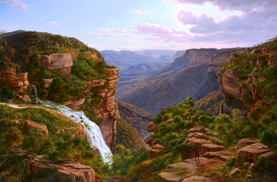
 |
| The Falls from Fletcher's Lookout November 2005 |
The waterfall we now know as Wentworth Falls may well have been sighted during the first
European crossing of the Blue Mountains in 1813. The expedition had been
following the ridge dividing the streams flowing north into the Grose River and
those flowing south into the Nepean River (Glenbrook Creek, Bedford Creek etc).
Their route brought them out onto the edge of King’s Tableland, south of the
present day township of Wentworth Falls, forcing them to deviate to the north
to get around the cliffs of what we now call the Jamison Valley.
Whether George Evans or William Cox saw the falls
(1813-1815) I have been unable to establish, but as Governor Lachlan Macquarie’s party was
taken out in 1815 to see the falls and the valley we must assume that they were already known by then. Macquarie named the falls “Campbell’s Cataract”, after his secretary John Thomas Campbell, who
was actually his wife Elizabeth’s brother. The name “Jamison Valley” (various spellings) dates from this time, also “Prince Regent’s Glen” and “King’s Tableland”.
 |
| The Weatherboard Creek Falls. Eugene Von Guerard 1862 |
Despite Governor Brisbane renaming the falls to “Bougainville Falls” in 1825 to honour
the leader of a French scientific expedition at that time, the public began to
use the name “Weatherboard Falls”,
after Cox’s 1814 weatherboard store hut built on Jamison Creek, upstream of the
falls, and later the Weatherboard Inn,
built 1826-29. Most travellers who could afford to stay at an inn stayed here,
and many walked out to see the falls and the valley.
Charles
Darwin recorded his visit in 1836 in his account of the
voyage of the Beagle; he appears to have stayed at the Weatherboard Inn on his
outward journey to Wallerawang and Bathurst and again on his return, walking to the falls on
both occasions.
 |
| The Weatherboard Falls, Blue Mountains. JH Carse 1876 |
The name “Weatherboard Falls” began to be replaced
by “Wentworth Falls” following the
renaming of the railway station in 1879. The falls became the centrepiece of
the reserve established there, formerly administered by a local trust, then by
the Blue Mountains City Council and now by the National Parks and Wildlife
Service. More will be said about this in a later blog entry.
Here are some useful sites you can visit. Firstly,
from the Wild Walks site, covering
the track to the top of the falls via Fletcher’s Lookout, then the Undercliff
Track and finally the Princes Rock track here, here and here .
 |
| Wentworth Falls February 2013 |
The photograph of Wentworth Falls in extreme flood
in February 2013 comes from this article here.
Here are two interesting videos. The first shows
the falls in flood here and the second in strong wind here.
Finally, my own You Tube site, which includes a video on a walk to the falls via
Fletcher’s Lookout, returning via the Undercliff and Princes Rock tracks here .
The two paintings illustrated are on display in
the National Gallery of Victoria, Melbourne.
https://johnsbluemountainsblog.blogspot.com/2013/12/links-to-all-blog-entries-and-relevant.html All Blue Mountains blogs and videos
All New England and other Geology blogs and videos
Limestone Caves of NSW
Song Studies. Bible studies based on hymns and songs
Shoalhaven District Geology.
 |
| The Weeping Rock, Wentworth Falls. June 1958 |
No comments:
Post a Comment