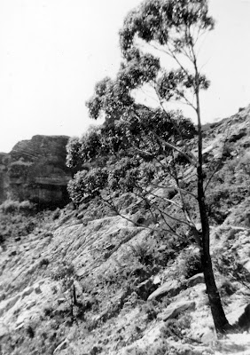
THE KATOOMBA LANDSLIDES OF 1931
 |
| Photo taken June 1960 |
What was once a place of high drama is now practically
forgotten. The site of these great landslides cannot be seen from any of the
well-known lookouts, nor does a sign point to any place from which it can be seen
(with the exception of the track from the Scenic Railway). In fact, with the
continued discoloration of the once-clean rock face as oxidation takes effect
and plants make it their home, the site is beginning to look much the same as
the rest of the cliff line. The site is usually referred to as at “the Dog Face Rock”. Presumably this
landmark was lost when the cliff collapsed.
Even the jumble of debris at the base of the cliff and down
into the valley is becoming overgrown in spite of gravity pulling it further
down the slope.
So, what is the story of this place and where can you go to
see what remains? We only know that cracks behind the top of the cliffs were
first reported in 1929, apparently by a miner returning from work at the coal
mine in the valley below.
It became apparent that a major rock fall was imminent,
though what that might mean in geological terms wasn’t at all clear, since
no-one had witnessed anything like this in the Blue Mountains previously (nor
has it been observed since, to my knowledge). As 1930 advanced, the cracks
widened noticeably and pieces of rock regularly detached themselves and hurtled
into the valley below. Crowds came to watch, hoping to be there for the climax
when hundreds of thousands of tons of rock would fall in one great mass.
%2B(2).jpg) |
| 2014 |
January 1931 arrived. By this time anybody and everybody was
practically holding their breath, waiting for the GREAT EVENT. See the Sydney Morning Herald article (Tuesday
27th January 1931) here. It happened (unfortunately, as these
things tend to happen) around 4am on the
morning of 29th January. There were no witnesses and no
photographs, though there are plenty of the lead-up and the aftermath. This was
not the end, as things turned out, because it soon became obvious that there
would be a further fall before long. This took place on Saturday 2nd May, at around 2pm, according to the Herald report in the edition of Monday 4 th
May, page 9 (here). The report mentions witnesses, but evidently they
weren’t carrying cameras and I can’t even find a mention of their names. It’s a
bit late in 2014 to be asking for eyewitness reports, though. The Sydney Mail of Wednesday 6th
May has a good report, including some photographs taken at around the time of
the fall (here). There must have been many smaller falls after this, but
people’s interests moved on. This all happened during the Great Depression and
there more pressing issues to worry about than yet another landslide at
Katoomba.
%2B(2).jpg) |
| 2014 |
So where can you go to see
the site today? If you take the walk from the bottom of the Scenic Railway towards the Ruined
Castle, you will soon find yourself crossing the debris field of the Landslide.
See my video on this walk here.
Landslide Lookout
is perched at the highest point of the actual break in the sandstone cliff, but
you can’t see the landslide itself from here. You can, however get a good view
from Narrow Neck Lookout by heading
off through the scrub to the left (ie, away from the Narrow Neck below you). See
my video Cliff Drive Lookouts here.
There are many places along Glenraphael Drive (which goes along the Narrow Neck
peninsula) where you can see the landslide, but naturally they are further
away. See my video Narrow Neck Lookouts here.
%2B(2).jpg) |
| Landslide Lookout 2014 |
An assortment of photographs may be found in Trove here.
https://johnsbluemountainsblog.blogspot.com/2013/12/links-to-all-blog-entries-and-relevant.html All Blue Mountains blogs and videos
All New England and other Geology blogs and videos
Limestone Caves of NSW
Song Studies. Bible studies based on hymns and songs
Shoalhaven District Geology
 |
| June 1963 |

.jpg)
.jpg)
.jpg)

%2B(2).jpg)
.jpg)
.jpg)
.jpg)