Search This Blog

Saturday, 19 April 2014

ROCKET POINT LOOKOUT, WENTWORTH FALLS NSW AUSTRALIA

ROCKET POINT LOOKOUT, WENTWORTH FALLS 
NSW AUSTRALIA
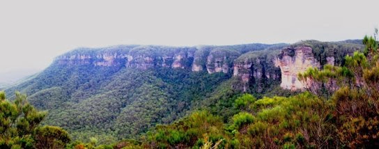
Rocket Point Lookout from Princes Rock
Rocket Point Lookout is one of the oldest constructed lookouts in the Blue Mountains. Like Fletcher's Lookout and the Princes Rock Lookout, which is immediately across the valley, all have a “parapet” construction (now reinforced with the usual steel poles, bars and wire). It is believed that the work was done by Peter Mulheran, some time in the 1880’s and probably largely by him alone.
Mulheran is one of the best known names associated with Wentworth Falls. He was operating a small guest house and guiding service at the time and appears to have undertaken to build many of the tracks we know and love today. Later on he was a member of the Wentworth Falls Reserves Trust. We owe the man a great debt indeed.
Another well known Wentworth Falls name from those days is Captain John Murray. He was the Chairman of the Trust at the time Peter Mulheran and his assistants were engaged in the construction of the now famous National Pass track. This track descends into the valley by means of a staircase carved from the cliff face below the Rocket Point Lookout. Murray is generally credited with having identified the route by being lowered over the cliff on a bosun’s chair. No doubt his seafaring background qualified him for this job, but he would have been over 70 at the time.
Approaching the lookout from Wentworth Falls
The name “Rocket Point” appears in a “Herald” article dated 17th October 1889, which is several years before the Murray’s arrival in Wentworth Falls. Some have attributed the name to his practice of firing off flares or rockets from this point to enable people below to get a compass bearing on the point. The dates are against this being the correct explanation. Others use the name “George Murray”, but I can find no such person associated with Wentworth Falls in those days.
An obituary of John Murray appeared on page 6 of the Sydney Morning Herald for Tuesday 4th February, 1919.
The Mountaineer guidebooks (early 20th century) contain remarks that the cliffs of Rocket Point are the highest in Australia at 1,000 feet, though how true either statement is, I cannot say. Whatever the truth, this is a most impressive spot and well worth a visit. The lookout is only about a 15 minute walk past the stepping stones at the top of the falls, branching off the National Pass track.
My video of the walk is here.
Top of the Falls from the lookout

Wednesday, 9 April 2014

HINKLER PARK, KATOOMBA BLUE MOUNTAINS NSW AUSTRALIA

HINKLER PARK, KATOOMBA BLUE MOUNTAINS 
NSW AUSTRALIA

Hinkler Memorial Park is in Warialda St Katoomba, between Katoomba St and Lurline St. What distinguishes it from most other parks in the Blue Mountains is that it offers both a shelter shed and toilets as well as a children’s play area and a pleasant environment. It may not be very large but it is certainly very popular. You will probably only have it to yourself on a wet day.
Apparently the place was known as Lurline St Park before 1933, though I have been unable to find anything to suggest that there were any facilities there at all. All that was to change.
Herbert John Louis Hinkler (always known simply as Bert Hinkler) was born in Bundaberg, Queensland, in 1892. His interest in flying went back to his childhood and it was no surprise that he served, first in the Royal Naval Air Service and then in the RAF during the First World War, concluding the war as a pilot in Italy in 1918.
He was catapulted to fame in 1928 when he became the first person to fly solo from England to Australia, taking just under 15 ½ days. An unassuming man, Bert became an advocate for the aeroplane as he flew many new routes, solo whenever possible. He was killed in Italy in January 1933 when his plane crashed as he sought to break the new solo flight record to Australia of 8 days and 20 hours. He was greatly admired and Australians everywhere mourned his passing.                     
Hinkler Park 1938
The Katoomba Municipal Council determined to honour his memory by creating the park we know today. As you can see from the photographs and my video (here) they did a great job. See the Sydney Morning Herald article about the opening here.
Commemorative plaque on shelter
You might also enjoy hearing the man himself speak on a recording here. 
There is one small mystery you might like to help solve. At the top of the plaque commemorating the opening, which is on the side of the shelter shed, there is an engraving of what I assume was one of Hinkler’s planes. It is not the one he flew on the record breaking flight in 1928. Is it perhaps the one in which he was killed in 1933?
Note May 2024. It is.

Friday, 4 April 2014

CLIFF DRIVE LOOKOUTS, KATOOMBA NSW AUSTRALIA

CLIFF DRIVE LOOKOUTS, KATOOMBA NSW AUSTRALIA

Eagle Hawk Lookout
In September 1937 a section of Cliff Drive, Katoomba was declared open by the Hon Eric Spooner, Minister for Works and Local Government in NSW. Mr Spooner was involved in a number of other official openings around Katoomba around this time, so we can assume that he liked the place.
The Cliff Drive, constructed by the then Katoomba Municipal Council, opened up a number of lookouts in places which must have been reasonably difficult to get to before then.
Approaching from the Scenic World end, the first is Eagle Hawk Lookout, which offers one of the best views of the Three Sisters and the cliffs between Echo Point and Katoomba Falls. There is limited parking (only two or three car spaces, which might all be taken up by a tourist coach). The lookout is down a short flight of steps, but even from the top the view is quite remarkable.                                           
Orphan Rock from Malaita Point Lookout

Malaita Point Lookout follows soon after, also on the left. There is presently no sign, only a gap in the safety railing to indicate the beginning of the track. There is parking on the opposite side of the road; however, as it is on fairly sharp bend, drivers need to take special care when making the necessary U turns on what has become a busy road.
The island of Malaita is one of the Solomon Islands and gave its name to a well know steamship serving the Pacific islands in the first half of the 20th century. Malaita Point might have taken its name from the ship. Others have suggested that the name was given because of the presence of a group of Malaita islanders who were undergoing training with a mission society in premises nearby, early in the century.
The view from the lookout is spectacular and includes a rare view of the back of Orphan Rock. The cliffs are popular with rock climbers and were the scene of a recent fatal accident. See this Sydney Morning Herald article for more information.
Landslide Lookout from Narrow Neck Lookout
Next comes Landslide Lookout, with parking on both sides of the road. The track to the lookout descends to a point looking towards the Narrow Neck. Standing there you will be quite unaware of the fact that you are standing on the brink of the great 1931 landslide, a fact which is brought home only when you look back from Narrow Neck Lookout.
The Cyclorama Point track is immediately opposite that to Landslide Lookout. When you read accounts of the views from this spot (eg this one from the Herald, 18th September 1937) you ascend the steps with great anticipation. Alas, the bush has grown to such an extent that the view is almost totally obscured today. The whole article makes good reading and may be read in Trove by clicking here.
Narrow Neck Lookout is several minutes further on. It has the best parking of all these lookouts and also a picnic table (not the shelter that used to be here). Tree growth is rapidly obscuring the otherwise fantastic view of the Narrow Neck. Don’t miss the view on the left of the cliff face remaining after the 1931 landslide. 
Note April 2024. You now have to pay to park here.

Hilda’s Lookout (source of name unknown – perhaps she lived nearby) is relatively recent and is also suffering from obscuring vegetation.

Friday, 28 March 2014

SUBLIME POINT, LEURA NSW AUSTRALIA

Rear view of the Three Sisters
While the Sublime Point Lookout doesn’t attract the crowds of many other Blue Mountains lookouts, it still has much to offer.
Sublime Point seems to have first come to public notice (at least, under the present name) around 1890-95. Mr WH Copeland, a Katoomba businessman, found a way into the Jamison Valley from the Point (Copeland Pass). This way into the valley is used today by rock climbers, who have developed many routes on the imposing cliffs in the area.

The path and picnic facilities probably date from the 1950’s and resemble those at Cahill’s Lookout, which dates from the same period.   One unexpected feature is the tap at the end of the path, several hundred metres from the parking  
Distant view of the Katoomba skyline
area, which also has one. The provision of a shelter shed and picnic tables near the lookout is very welcome, though it is quite a way to carry your picnic gear from the car.
You will need to follow your road maps carefully to find the way out to Sublime Point. Basically, the route is the same as for Fairmont Resort and the Leura Golf Course, where Sublime Point Road actually commences.
The area has seen many cases of lost bushwalkers and a number of fatal climbing accidents. It came to prominence in September 2013 when the body of a missing guest from Fairmont was discovered wedged in a tree part way down the cliff on the western side of Sublime Point.
An article in the Sydney Morning Herald about the discovery of the body may be found here.
Gary Tweddle disappeared from Fairmont in the early hours of July 16th 2013. There is a memorial plaque to Gary along a track which branches off to the right about half way between the car park and the picnic area. This track leads around the cliff top to Golf Links Lookout, if you succeed in following it through the scrub and across people’s backyards.
My video on Sublime Point will be found here. 

From a 1905 Katoomba guide book.


Distant view of Mt Gibraltar, Bowral

Sunday, 23 March 2014


LILLIANS BRIDGE WENTWORTH FALLS, 
BLUE MOUNTAINS NSW AUSTRALIA
Taken before 1927
It’s a matter of opinion whether we locate this celebrated bridge in Leura or Wentworth Falls, it is in fact on the boundary between the two. Its presence across the gorge known as Lillian’s Glen makes it possible to walk conveniently from Fairmont Resort in Leura down to the Glen and then follow the tracks up or down the Valley of the Waters, returning the same way or by bus (if you can work out the times and routes). A simpler way would be to leave cars at both ends of the walk, if you are going with a group.
Who was the Lillian (or should it be Lilian ?) after whom the bridge and glen were named? The obituary of Elizabeth Lilla Murray (Sydney Morning Herald, Wednesday 20th September 1916, page 5) tells us that she was the wife of Captain Murray, who was for many years Chairman of the Wentworth Falls Reserve Trust. According to this obituary, “Lilian’s Glen and Lilian’s Bridge, above the Valley of the Waters, are associated with Mrs Murray’s name”.
I believe the bridge was built around 1895. “The Bridge, which consists of an iron framework with wooden fittings, is only 21 feet wide, and yet it spans a gorge over 200 feet deep, and miles in length.” So says an article in the 1905 Katoomba and Leura Guidebook. No doubt repairs were made to the structure many times over the years, but by the early 21st century it was in a state of disrepair.
Photo taken in 2007
The 2007 photograph shows it as being closed to all traffic. (I’m sorry, I don’t know the source of this photo so please forgive me whoever took it.)
The approach from the Leura side 2013
The top photo was taken before 1927 (from the Mountaineer tourist guidebook of that year) and could be at least 20 years older than that. It gives a good impression of the structure of the bridge. 
Point of entry to the gorge below the bridge

The bridge has now been restored by the National Parks and Wildlife Service and should last for many years to come. If you are bold, follow the Nature Track until you reach the creek in Lillian’s Glen and then go downstream until you are underneath Lillian’s Bridge.
The approach from the Wentworth Falls side 2013

Sunday, 16 March 2014

PECKMAN’S PLATEAU LOOKOUT KATOOMBA NSW AUSTRALIA

PECKMAN’S PLATEAU LOOKOUT KATOOMBA 
NSW AUSTRALIA

Bonnie Doon Falls
Commencing at the picnic area adjoining the Cahill’s Lookout car park, in the western part of Katoomba, a little used track leads out across Peckman’s Plateau to an almost unknown lookout. The views out here are as good as anywhere around Katoomba and it is surprising that little has been done to promote this spot or even to let the public know of its existence.
Harry Peckman was one of the great “characters” of early Katoomba. He moved there in 1884 and spent most of his time as a horse cab and coach driver. He was a great “spinner of yarns” and many visitors attested to how much his knowledge and enthusiasm for the mountains added to the enjoyment of their visit.
Harry Peckman 1920's
He wrote much poetry, not of the highest quality, it has to be admitted, but words which overflowed from his heart and revealed the inner man. He died in October 1934 at the age of 88, by which time he must have been one of the best known residents of the Blue Mountains. The "Nepean Times" of 22nd December 1888 had this to say: “He has graphically portrayed the varied and sublimities of Govett’s Leap with a delicacy of feeling which was as welcome as it was unexpected. The poem in question was recited by the author, and was received with marks of great approval.”

The Nepean Times of Saturday 6th October 1934 tells the story of Harry Peckman on page 6. He occupies a unique position in Blue Mountains history. A biography titled “The Prince of Whips: The Life and Works of the Blue Mountains Pioneer Harry Peckman”, by Jim Smith and John Low, may still be available for purchase.
North's Lookout across the valley
The Plateau named after Harry and his family was apparently given this name because they cleared a track to viewpoints on the cliff edge. The present walking track, decrepit picnic area and fenced lookout probably date from the early 1970’s. The lookout provides a fine view of the lowermost of the Bonnie Doon Falls, once known as “Ethel Fall”. There are also great views of Radiata Plateau and Nellie’s Glen. It is the best spot to see these places, which are well off the path of most tourists. The track to the lookout is easy, if a little overgrown, and the return walk takes rather less than an hour.
Note: The picnic area has been reconstructed since the above was written but visitors seem to be few. Most of these park on the left a few hundred metres from Cahill's Lookout rather than use the overgrown track from there.
My video about Cahill's and Peckman's lookouts may be found here. 
The Blog entry about Cahill's Lookout may be found here. 

Radiata Plateau from Peckman's Plateau Lookout

Monday, 10 March 2014

CAHILL’S LOOKOUT, KATOOMBA BLUE MOUNTAINS NSW AUSTRALIA

CAHILL’S LOOKOUT, KATOOMBA 
BLUE MOUNTAINS NSW AUSTRALIA

John Joseph Cahill was the Premier of New South Wales from 1952 to 1959. It was in his term of office that such well known Sydney landmarks as the Cahill Expressway at Circular Quay and the Sydney Opera House were planned. The Blue Mountains City Council named this magnificent lookout in his honour.
Unlike most of the Katoomba lookouts such as those at Echo Point and Scenic World, which overlook the Jamison Valley, this one overlooks the Megalong Valley. The two valleys are separated by the Narrow Neck, a remnant of the sandstone plateau which projects southwards for many kilometres.
The streams which formed the Megalong Valley have eroded through the Sydney Basin sediments into the underlying granite and other older rocks. Much of the western side of the valley has been cleared for sheep and cattle grazing.
The Boar's Head
Two well known landmarks visible from Cahill’s Lookout are the Boar’s Head Rock (easily seen on your left towards Narrow Neck) and the Six Foot Track to Jenolan Caves. The track may be seen snaking through the forest below the lookout (the bottom one, that is) after the descent through Nellie’s Glen, which is on your right.
There is a picnic area alongside the parking area at the beginning of the concrete path and steps leading down to the lookout. Unfortunately there are no toilet facilities. However there is a tap near the path and an overgrown drinking fountain (bubbler to we older Australians) at the lookout. I can’t say whether they work or not, but the ones at Sublime Point lookout, which date from the same period, certainly do.
This spot is one of the best places in the Blue Mountains to enjoy a sunset, because of its westerly aspect. It is reached from the loop section of Cliff Drive (Blue Mountains Drive), shortly after passing the golf course, proceeding from the direction of Scenic World.
My video on Cahill’s Lookout may be found here. Another video, taken on a very windy day, is here. 
The picnic area and access paths were reconstructed after the 2014 bushfire and now attract many more visitors. See my video "Cahill's Lookout Reopened" here.

Nellie's Glen from Cahill's Lookout