Search This Blog

Showing posts with label Cliff Drive. Show all posts

Friday, 6 October 2017

CYCLORAMA POINT, CLIFF DRIVE KATOOMBA

Cyclorama Point Katoomba


The word cyclorama comes from the theatre, where it refers to the backdrop at the back of a stage, in front of which the action takes place. Its use for this lookout no doubt refers to the extensive view around the horizon, with the Jamison Valley, Narrow Neck and Mt Solitary making up the “foreground”.
That’s what you would have seen had you gone there in 1936, when the Bathurst Road – Echo Point section of the new Cliff Drive was officially opened. Today the view is largely obstructed by trees and whatever appeal the lookout might once have had has now been lost. Few visit the place these days yet the tracks to it can be clearly seen from the road and are well signposted.
This has led to the preservation of the lookout more or less as it was when the work was completed in 1936, one of the few places in the Mountains where modernisation has not yet reached. Even the brass direction indicator remains intact. These were once plentiful but vandals and thieves have destroyed most of them.
I have been unable to find any older photographs of Cyclorama Point and even published references to it are few, apart from those referring to the new Cliff Drive and later listings of tourist attractions. 

The nearby Landslide Lookout is right on the edge of the cliff, immediately above the 1931 landslide. You can’t see the landslide from the lookout, however. It’s worth visiting both lookouts when you visit, but there’s only enough parking for a few cars on each side of Cliff Drive.
View my video on these lookouts here:
The newspaper extracts can easily be found in the digitised newspaper files in Trove here. The satellite image is from Google Earth. The landslide and lookout is on the left; Cyclorama Point is in the centre.


Friday, 21 November 2014

THE KATOOMBA LANDSLIDES OF 1931

THE KATOOMBA LANDSLIDES OF 1931

Photo taken June 1960
What was once a place of high drama is now practically forgotten. The site of these great landslides cannot be seen from any of the well-known lookouts, nor does a sign point to any place from which it can be seen (with the exception of the track from the Scenic Railway). In fact, with the continued discoloration of the once-clean rock face as oxidation takes effect and plants make it their home, the site is beginning to look much the same as the rest of the cliff line. The site is usually referred to as at “the Dog Face Rock”. Presumably this landmark was lost when the cliff collapsed.
Even the jumble of debris at the base of the cliff and down into the valley is becoming overgrown in spite of gravity pulling it further down the slope.
So, what is the story of this place and where can you go to see what remains? We only know that cracks behind the top of the cliffs were first reported in 1929, apparently by a miner returning from work at the coal mine in the valley below.
It became apparent that a major rock fall was imminent, though what that might mean in geological terms wasn’t at all clear, since no-one had witnessed anything like this in the Blue Mountains previously (nor has it been observed since, to my knowledge). As 1930 advanced, the cracks widened noticeably and pieces of rock regularly detached themselves and hurtled into the valley below. Crowds came to watch, hoping to be there for the climax when hundreds of thousands of tons of rock would fall in one great mass.
2014
January 1931 arrived. By this time anybody and everybody was practically holding their breath, waiting for the GREAT EVENT. See the Sydney Morning Herald article (Tuesday 27th January 1931) here. It happened (unfortunately, as these things tend to happen) around 4am on the morning of 29th January. There were no witnesses and no photographs, though there are plenty of the lead-up and the aftermath. This was not the end, as things turned out, because it soon became obvious that there would be a further fall before long. This took place on Saturday 2nd May, at around 2pm, according to the Herald report in the edition of Monday 4 th May, page 9 (here). The report mentions witnesses, but evidently they weren’t carrying cameras and I can’t even find a mention of their names. It’s a bit late in 2014 to be asking for eyewitness reports, though. The Sydney Mail of Wednesday 6th May has a good report, including some photographs taken at around the time of the fall (here). There must have been many smaller falls after this, but people’s interests moved on. This all happened during the Great Depression and there more pressing issues to worry about than yet another landslide at Katoomba.
2014
So where can you go to see the site today? If you take the walk from the bottom of the Scenic Railway towards the Ruined Castle, you will soon find yourself crossing the debris field of the Landslide. See my video on this walk here
Landslide Lookout is perched at the highest point of the actual break in the sandstone cliff, but you can’t see the landslide itself from here. You can, however get a good view from Narrow Neck Lookout by heading off through the scrub to the left (ie, away from the Narrow Neck below you). See my video Cliff Drive Lookouts here. There are many places along Glenraphael Drive (which goes along the Narrow Neck peninsula) where you can see the landslide, but naturally they are further away. See my video Narrow Neck Lookouts here.

Landslide Lookout 2014

From below June 1960


June 1963
 

Saturday, 26 April 2014

CASTLE HEAD WALK, NARROW NECK KATOOMBA, BLUE MOUNTAINS NSW AUSTRALIA

CASTLE HEAD WALK, NARROW NECK KATOOMBA, BLUE MOUNTAINS NSW AUSTRALIA
If you stand at Echo Point and look across to the Ruined Castle, Castle Head is the point of land immediately behind it. What appears to be a solid tableland is in reality a narrow projection of land into the valley. Near its end it’s only a few metres across, making it an exciting place to stand. Like most such places it is only dangerous if you do silly things.
To get to this spot looks difficult. It’s not. Take the road to Narrow Neck from Cliff Drive, Katoomba. You’ll find the turnoff (Glenraphael Drive, an unsealed road) on the left as you drive around past Scenic World. It’s the only left hand turn along here.
The road descends to the first Narrow Neck before rising again onto the higher ground beyond. There is a car park at the track turnoff to the Golden Stairs, and another at the locked gate across the road shortly after. (There is a steep concrete section of road between the two, constructed to overcome severe erosion problems on the steep hill.)
From the locked gate on, you walk. The track to Castle Head turns off on the left about 15 minutes after you start walking. It’s marked by two round posts, the left one has “Castle Head” written on it in pencil or charcoal. (The track is not shown on the map opposite.) From here you are on a narrow foot pad through the bush, which soon comes to the cliff edge and then follows it to a Trig station (surveyors mark) and finally to the end of the headland.
Hikers on the Ruined Castle
The views along here are amazing in all directions. You can see the 1931 landslide, Katoomba Falls, Echo Point, the Three Sisters, Sublime Point and across to Kings Tableland. Below, looking east, is the Ruined Castle itself (which is the origin of the name Castle Head), behind which is Mt Solitary with the track to the summit easily visible. To the right of this is the gorge of Cedar Creek with Lake Burragorang beyond. (This is the water backed up by Warragamba Dam). A continuous vista of cliffs and valleys leads around to the continuation of the Narrow Neck peninsula. If it’s been raining, you will see a waterfall coming over the cliffs opposite.                                                              
The distant view of Katoomba Falls
Yellow-tailed black cockatoos

This is a popular abseiling spot and there are quite a few YouTube videos about this. The link to one of these is here. My video of the walk is here and a Bushwalking NSW link is here.
It is about a 2 hour return walk from the locked gate, one that you will always remember. Happy hiking! 


Wednesday, 23 April 2014

BONNIE DOON TRACK, KATOOMBA BLUE MOUNTAINS NSW AUSTRALIA

BONNIE DOON TRACK, KATOOMBA 
BLUE MOUNTAINS NSW AUSTRALIA

View of Nellie's Glen from North's Lookout
The area known as “Bonnie Doon” lies on the western side of Katoomba, south of the “Explorers' Tree” and adjacent to Nellie’s Glen. There have been tracks through this area since the 19th century, though the present day one appears to have been constructed about 25 years ago, judging from its deteriorating condition. Today’s track seems to be in a different location from those shown on old maps.
The track basically runs between two lookouts (North’s and Therabulat) crossing several minor streams as it winds through bush land. Sadly, there are no views of the cascades and waterfalls which the walker can hear further down the valleys. It is as if the track has been constructed in the most economical way possible to connect two points while staying away from the more difficult places, which no doubt are the very ones the walker would like to see.                                                                                 

It is possible to see the lowermost of the so-called Bonnie Doon Falls from Peckman’s Plateau Lookout, on the cliff top south of Therabulat Lookout (see my video here) or from a track which leaves the Six Foot track in Nellie’s Glen. This is the fall identified as Ethel Fall in early accounts of the locality. The other falls (3, according to the 1909 map illustrated) remain hidden from view.
Access to the area is from the Nellie’s Glen car park (just past where the Explorers' Tree used to be), turn left off the highway), which takes you down to North’s Lookout and from the end of Stuart’s Road, off Cliff Drive. This leads to Therabulat Lookout (take a left branch). Either way, if you  
The view from Therabulat Lookout to Megalong Valley
continue far enough along the track, you will encounter a newly constructed track coming from who knows where (no signpost in March 2014). Why this track has been pushed through a declared Fauna Study Area (thus destroying hundreds of thousands of native plants) is anyone’s guess.
The other disturbing feature of the walk is the evidence which remains around Nellie’s Glen of the environmental damage caused when an attempt was made to construct a fire trail down the Glen some years ago. One could be excused for thinking that the powers-that-be are less concerned about the scenic and conservation values of this part of Katoomba than they are, say, of those around Katoomba Falls and Echo Point. When you read old newspaper accounts of Bonnie Doon you will soon discover that this has always been an area which has suffered from the hands of timber getters, wild flower pickers, bush rock gatherers and the like. It is an attractive and interesting place and deserves to be better appreciated.
From a 1905 guide book
There are many accounts of walks in this area. Simply Google “Bonnie Doon” Katoomba to come up with a list.  My video on Bonnie Doon is here and the one on Peckman’s Plateau is here

The top of Ethel Fall from North's Lookout
Yellow Tailed Black Cockatoo

Friday, 4 April 2014

CLIFF DRIVE LOOKOUTS, KATOOMBA NSW AUSTRALIA

CLIFF DRIVE LOOKOUTS, KATOOMBA NSW AUSTRALIA

Eagle Hawk Lookout
In September 1937 a section of Cliff Drive, Katoomba was declared open by the Hon Eric Spooner, Minister for Works and Local Government in NSW. Mr Spooner was involved in a number of other official openings around Katoomba around this time, so we can assume that he liked the place.
The Cliff Drive, constructed by the then Katoomba Municipal Council, opened up a number of lookouts in places which must have been reasonably difficult to get to before then.
Approaching from the Scenic World end, the first is Eagle Hawk Lookout, which offers one of the best views of the Three Sisters and the cliffs between Echo Point and Katoomba Falls. There is limited parking (only two or three car spaces, which might all be taken up by a tourist coach). The lookout is down a short flight of steps, but even from the top the view is quite remarkable.                                           
Orphan Rock from Malaita Point Lookout

Malaita Point Lookout follows soon after, also on the left. There is presently no sign, only a gap in the safety railing to indicate the beginning of the track. There is parking on the opposite side of the road; however, as it is on fairly sharp bend, drivers need to take special care when making the necessary U turns on what has become a busy road.
The island of Malaita is one of the Solomon Islands and gave its name to a well know steamship serving the Pacific islands in the first half of the 20th century. Malaita Point might have taken its name from the ship. Others have suggested that the name was given because of the presence of a group of Malaita islanders who were undergoing training with a mission society in premises nearby, early in the century.
The view from the lookout is spectacular and includes a rare view of the back of Orphan Rock. The cliffs are popular with rock climbers and were the scene of a recent fatal accident. See this Sydney Morning Herald article for more information.
Landslide Lookout from Narrow Neck Lookout
Next comes Landslide Lookout, with parking on both sides of the road. The track to the lookout descends to a point looking towards the Narrow Neck. Standing there you will be quite unaware of the fact that you are standing on the brink of the great 1931 landslide, a fact which is brought home only when you look back from Narrow Neck Lookout.
The Cyclorama Point track is immediately opposite that to Landslide Lookout. When you read accounts of the views from this spot (eg this one from the Herald, 18th September 1937) you ascend the steps with great anticipation. Alas, the bush has grown to such an extent that the view is almost totally obscured today. The whole article makes good reading and may be read in Trove by clicking here.
Narrow Neck Lookout is several minutes further on. It has the best parking of all these lookouts and also a picnic table (not the shelter that used to be here). Tree growth is rapidly obscuring the otherwise fantastic view of the Narrow Neck. Don’t miss the view on the left of the cliff face remaining after the 1931 landslide. 
Note April 2024. You now have to pay to park here.

Hilda’s Lookout (source of name unknown – perhaps she lived nearby) is relatively recent and is also suffering from obscuring vegetation.

Sunday, 16 March 2014

PECKMAN’S PLATEAU LOOKOUT KATOOMBA NSW AUSTRALIA

PECKMAN’S PLATEAU LOOKOUT KATOOMBA 
NSW AUSTRALIA

Bonnie Doon Falls
Commencing at the picnic area adjoining the Cahill’s Lookout car park, in the western part of Katoomba, a little used track leads out across Peckman’s Plateau to an almost unknown lookout. The views out here are as good as anywhere around Katoomba and it is surprising that little has been done to promote this spot or even to let the public know of its existence.
Harry Peckman was one of the great “characters” of early Katoomba. He moved there in 1884 and spent most of his time as a horse cab and coach driver. He was a great “spinner of yarns” and many visitors attested to how much his knowledge and enthusiasm for the mountains added to the enjoyment of their visit.
Harry Peckman 1920's
He wrote much poetry, not of the highest quality, it has to be admitted, but words which overflowed from his heart and revealed the inner man. He died in October 1934 at the age of 88, by which time he must have been one of the best known residents of the Blue Mountains. The "Nepean Times" of 22nd December 1888 had this to say: “He has graphically portrayed the varied and sublimities of Govett’s Leap with a delicacy of feeling which was as welcome as it was unexpected. The poem in question was recited by the author, and was received with marks of great approval.”

The Nepean Times of Saturday 6th October 1934 tells the story of Harry Peckman on page 6. He occupies a unique position in Blue Mountains history. A biography titled “The Prince of Whips: The Life and Works of the Blue Mountains Pioneer Harry Peckman”, by Jim Smith and John Low, may still be available for purchase.
North's Lookout across the valley
The Plateau named after Harry and his family was apparently given this name because they cleared a track to viewpoints on the cliff edge. The present walking track, decrepit picnic area and fenced lookout probably date from the early 1970’s. The lookout provides a fine view of the lowermost of the Bonnie Doon Falls, once known as “Ethel Fall”. There are also great views of Radiata Plateau and Nellie’s Glen. It is the best spot to see these places, which are well off the path of most tourists. The track to the lookout is easy, if a little overgrown, and the return walk takes rather less than an hour.
Note: The picnic area has been reconstructed since the above was written but visitors seem to be few. Most of these park on the left a few hundred metres from Cahill's Lookout rather than use the overgrown track from there.
My video about Cahill's and Peckman's lookouts may be found here
The Blog entry about Cahill's Lookout may be found here

Radiata Plateau from Peckman's Plateau Lookout

Monday, 10 March 2014

CAHILL’S LOOKOUT, KATOOMBA BLUE MOUNTAINS NSW AUSTRALIA

CAHILL’S LOOKOUT, KATOOMBA 
BLUE MOUNTAINS NSW AUSTRALIA

John Joseph Cahill was the Premier of New South Wales from 1952 to 1959. It was in his term of office that such well known Sydney landmarks as the Cahill Expressway at Circular Quay and the Sydney Opera House were planned. The Blue Mountains City Council named this magnificent lookout in his honour.
Unlike most of the Katoomba lookouts such as those at Echo Point and Scenic World, which overlook the Jamison Valley, this one overlooks the Megalong Valley. The two valleys are separated by the Narrow Neck, a remnant of the sandstone plateau which projects southwards for many kilometres.
The streams which formed the Megalong Valley have eroded through the Sydney Basin sediments into the underlying granite and other older rocks. Much of the western side of the valley has been cleared for sheep and cattle grazing.
The Boar's Head
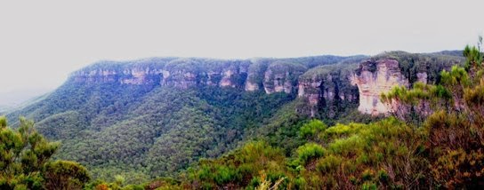
Two well known landmarks visible from Cahill’s Lookout are the Boar’s Head Rock (easily seen on your left towards Narrow Neck) and the Six Foot Track to Jenolan Caves. The track may be seen snaking through the forest below the lookout (the bottom one, that is) after the descent through Nellie’s Glen, which is on your right.
There is a picnic area alongside the parking area at the beginning of the concrete path and steps leading down to the lookout. Unfortunately there are no toilet facilities. However there is a tap near the path and an overgrown drinking fountain (bubbler to we older Australians) at the lookout. I can’t say whether they work or not, but the ones at Sublime Point lookout, which date from the same period, certainly do.
This spot is one of the best places in the Blue Mountains to enjoy a sunset, because of its westerly aspect. It is reached from the loop section of Cliff Drive (Blue Mountains Drive), shortly after passing the golf course, proceeding from the direction of Scenic World.
My video on Cahill’s Lookout may be found here. Another video, taken on a very windy day, is here
The picnic area and access paths were reconstructed after the 2014 bushfire and now attract many more visitors. See my video "Cahill's Lookout Reopened" here.

Nellie's Glen from Cahill's Lookout