Search This Blog

Showing posts with label park. Show all posts

Wednesday, 9 April 2014

HINKLER PARK, KATOOMBA BLUE MOUNTAINS NSW AUSTRALIA

HINKLER PARK, KATOOMBA BLUE MOUNTAINS 
NSW AUSTRALIA

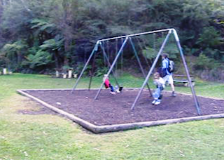
Hinkler Memorial Park is in Warialda St Katoomba, between Katoomba St and Lurline St. What distinguishes it from most other parks in the Blue Mountains is that it offers both a shelter shed and toilets as well as a children’s play area and a pleasant environment. It may not be very large but it is certainly very popular. You will probably only have it to yourself on a wet day.
Apparently the place was known as Lurline St Park before 1933, though I have been unable to find anything to suggest that there were any facilities there at all. All that was to change.
Herbert John Louis Hinkler (always known simply as Bert Hinkler) was born in Bundaberg, Queensland, in 1892. His interest in flying went back to his childhood and it was no surprise that he served, first in the Royal Naval Air Service and then in the RAF during the First World War, concluding the war as a pilot in Italy in 1918.
He was catapulted to fame in 1928 when he became the first person to fly solo from England to Australia, taking just under 15 ½ days. An unassuming man, Bert became an advocate for the aeroplane as he flew many new routes, solo whenever possible. He was killed in Italy in January 1933 when his plane crashed as he sought to break the new solo flight record to Australia of 8 days and 20 hours. He was greatly admired and Australians everywhere mourned his passing.                     
Hinkler Park 1938
The Katoomba Municipal Council determined to honour his memory by creating the park we know today. As you can see from the photographs and my video (here) they did a great job. See the Sydney Morning Herald article about the opening here.
Commemorative plaque on shelter
You might also enjoy hearing the man himself speak on a recording here. 
There is one small mystery you might like to help solve. At the top of the plaque commemorating the opening, which is on the side of the shelter shed, there is an engraving of what I assume was one of Hinkler’s planes. It is not the one he flew on the record breaking flight in 1928. Is it perhaps the one in which he was killed in 1933?
Note May 2024. It is.

Friday, 4 October 2013

LEURA CASCADES PICNIC AREAS BLUE MOUNTAINS NEW SOUTH WALES AUSTRALIA

LEURA CASCADES PICNIC AREAS BLUE MOUNTAINS NEW SOUTH WALES AUSTRALIA

This has been a favourite place for picnics since the Katoomba Baths were opened here in 1913. Before then, many people came down the tracks from both Katoomba and Leura stations to visit the Leura Cascades and Leura Falls, especially after the opening of the Federal Pass track earlier in the century. The completion of the baths, with associated change rooms, toilets and picnic areas brought many more visitors. The area remains popular today, with easy access from the Cliff Drive and regular stops by the coaches which visit the principal tourist spots.

2022 note: The area was closed for several years after heavy rain and landslides.It is now open for pedestrians and cyclists. Park at the Solitary Restaurant.

Just when the baths finally closed I have not been able to discover. The present Katoomba Aquatic Centre dates from 1972, but for at least 20 years before that the pool at nearby Catalina Park was drawing people away from this cold mountain swimming pool. The basic structure of the baths is still visible, having been filled in while the concrete walls were retained, which adds considerably to the interest of the place. 
The Baths around 1920
Mountaineer Tourist Guide 1927
 There isn’t a great deal of parking and the lower area tends to fill up early in the day as people head off on the various bush walks which radiate from here. The upper area isn’t far away, but it’s all up hill from the main facilities which is a bit off-putting if you’ve parked there and carried all your picnic gear down the hill.

The Prince Henry Cliff Walk, The Leura Cascades, The Bridal Veil Falls, the Amphitheatre walk and the Federal Pass are all easily accessed from here.


Saturday, 21 September 2013

MT VICTORIA PARK BLUE MOUNTAINS NEW SOUTH WALES AUSTRALIA

MT VICTORIA PARK 

BLUE MOUNTAINS NEW SOUTH WALES AUSTRALIA

Mt Victoria is on the western edge of the Blue Mountains. It came into existence mainly because of the coming of the railway in 1868, when it became the terminus while the Great Zig Zag was being constructed near Lithgow. This allowed the railway to descend from the mountains to the more fertile regions beyond. The development of Jenolan Caves as a tourist resort brought crowds to the town as it became the base for those coming from Sydney by train before transferring to road transport for the rest of the journey. Right from the construction of the first road across the Blue Mountains in 1815 until now, most road traffic has left the mountains at Mt Victoria.

Despite all of this development, the town’s population has not exceeded 1,000 and today it is a quiet mountain community which gives the impression that it plans to stay that way.

Mt Victoria Park is one of the most accessible spots along the Great Western Highway for travellers to stop for a break and they share it with the locals who clearly have a great deal of affection for the place.

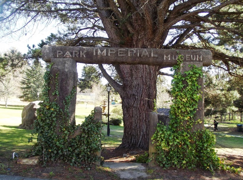
Two of its entrances have signs over them; that from the Highway calls the place “Memorial Park” while the Station St entrance rather grandly states “Imperial Park Museum”. This reflects the fact that the two sections of the park had different origins. The First World War memorial is a prominent feature of one, the original community owned part, while the other was formerly the property of the Imperial Hotel (across the road). It contains a number of bizarre structures which look like they might have once have held exhibits of some sort, perhaps animal dioramas, though I haven’t been able to confirm this. See the photos at the end of this blog. The board appeared in the park early in 2016.
The two were merged as “Mt Victoria Park” when the Blue Mountains City Council bought the lower section from the Hotel owners in 1979.

The stimulus for the purchase of the land now forming the core of the park seems to have been the centenary of the crossing of the Blue Mountains in 1913. While nearby Mt York was the focal point for the unveiling of memorials (just as it has been in 2013 for the bicentenary), a site was needed which was more suitable for festivities, which was more accessible and could accommodate a crowd. You can read about all this in the newspapers of the day. The photograph (source unknown) show the crowds making their way to the park for the celebrations in May 1913.

The park became the venue for large picnic groups soon after this, since it is handy to the railway station. Railway picnics brought thousands and you could say “a good time was had by all”.

The construction of the War Memorial must have been a great event too, and the newspaper reports reveal the tremendous emotional energy behind the occasion. It seems strange to us that it should have been unveiled 5 months before the war concluded. Reading between the lines, it seems that feelings were running high in the community, as they were in many other small places where some men were perceived as not “doing their duty”.

Some recommended reading (source www.trove.nla.gov.au): The 1913 Centenary celebrations (Clarence and Richmond Examiner (Grafton, NSW: 1889 - 1915), Thursday 29 May 1913, page 5);  
The 1914 Railways Picnic (Nepean Times (Penrith, NSW): 1882 - 1962), Saturday 12 September 1914, page 6); 
The March of the “Cooees” (The Sydney Morning Herald (NSW: 1842 - 1954), Friday 5 November 1915, page 8); 
The opening of the War Memorial (The Blue Mountain Echo (NSW: 1909 - 1928), Friday 7 June 1918, page 3).

View my Blue Mountains videos here . I have three other playlists - gem hunting/mining, Glen Innes and New Zealand. The video about  Mt Victoria Park is here.

This board appeared early in 2016
These are the three photographs on the information board.