Search This Blog

Showing posts with label map. Show all posts

Monday, 22 April 2019

1938 MAP AND WALKS INFORMATION (PART 2): THE BLUFF LOOKOUT GLENBROOK

1938 MAP AND WALKS INFORMATION (PART 2). THE BLUFF LOOKOUT GLENBROOK


You are strongly recommended to consult a modern street directory and to consult a current guide book to the Blue Mountains.
This link will take you to a short video (by pincbit) taken at the Bluff Lookout Glenbrook .


Wednesday, 17 April 2019

1938 MAP AND WALKS INFORMATION (Part 1)

1938 MAP AND WALKS INFORMATION (Part 1)


1938 MAP AND WALKING TOURS ON THE BLUE MOUNTAINS BETWEEN BLAXLAND AND WENTWORTH FALLS. This publication by the NSW Railways Department has maps and information on numerous walks. This page is simply the section which introduces the map. You will need to use it when you want explanations about symbols etc. This folder belonged to Grandma Hayward.

You will find a lot of interesting things that modern books will not mention (and vice versa, of course).

Wentworth Falls April 1957
If anyone has a copy of the related folder dealing with areas higher up the Blue Mountains than Wentworth Falls would they please let me know.


Thursday, 19 December 2013

FERN BOWER AND THE AMPHITHEATRE TRACK, LEURA BLUE MOUNTAINS NSW AUSTRALIA

FERN BOWER AND THE AMPHITHEATRE TRACK, LEURA BLUE MOUNTAINS NSW AUSTRALIA

The Bridal Veil and Weeping Rock 1960
The walking tracks around Leura Falls and Katoomba Falls were developed independently from the 1880’s. It became clear that a track linking the two via the valley would be a great asset, especially as the Rodriguez Pass at Blackheath and the National Pass at Wentworth Falls were being planned at about the same time. (It is obvious that the communities of Blackheath, Katoomba and Wentworth Falls were rivals in attracting tourists and their cash.) As it happened, both the Federal and Rodriguez passes were opened in 1900. The National Pass took longer and wasn’t finished until 1907.  
The difficult part in all of these constructions was the route into the valley from the heights above. .                                                                                  
Information board in Fern Bower
 Both tracks required the construction of many stone steps and wooden ladders and must have been exciting places to visit back then. They still are, of course, but without the element of danger involved in scaling a structure built on the spot out of local bush timber.

The original descent from the Amphitheatre Track to the level of the Federal Pass was via the Tunnel Track until this route was destroyed by flood and landslide in 1912. The Fern Bower route was then upgraded to become the main route down to the Pass, which it still is, though the Leura Cascades-Amphitheatre-lower Fern Bower route is a more scenic way to enter the valley, with many views of the cliffs, waterfalls and the valley.


The map in the 1927 edition of the Mountaineer tourist guide shows both tracks to the bottom, but this guidebook was notoriously out-of date, with much of its content dating back to the 1890’s. The track description from the same book includes place names which certainly aren’t signposted today. Below the Bridal Veil fall there are a number of old tracks which are worth exploring. You can follow the old sewer line down to the brink of the second fall (correctly called Leura Falls). Be careful if you do, because a number of lives have been lost here. Back when I was a teenager, I went down the old sewer workers’ ladder which used to be here. Not a good idea, but I made it in one piece.                                    
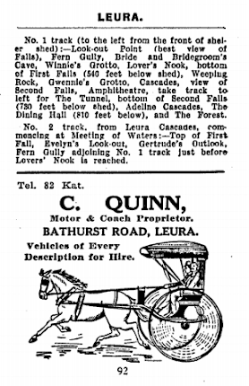
To the Leura Cascades, Sir?

Another thing to look out for just below the Bridal Veil is the Leura Weeping Rock. Like the Wentworth Falls version, it needs a good water flow to make it weep. When it does, it’s a sight not to be missed.

Fern Bower steps
Leura Falls from McKillop's Lookout, the Amphitheatre track

Thursday, 26 September 2013

UNCONFORMITY AT SOUTH BOWENFELS NEAR LITHGOW NEW SOUTH WALES AUSTRALIA

UNCONFORMITY AT SOUTH BOWENFELS NEAR LITHGOW NEW SOUTH WALES AUSTRALIA

Aplite dyke intruding granite (very weathered)
This is the first purely geological entry I’ve written for this Blog. Most readers will be familiar with the basic geology of the western Blue Mountains. Essentially, there is a series of sedimentary rocks resting on an eroded surface of older rocks, both igneous and sedimentary. The rocks that we see from lookouts such as Echo Point or Govett’s Leap consist of Triassic sandstones and siltstones (the Narrabeen Group, which forms the cliffs) and the Permian Illawarra Coal Measures (nonmarine) and Shoalhaven Group (marine) which form the slopes and more level areas below.

Once Victoria Pass is descended into the Hartley Valley, there comes a point near Hartley where the Permian Shoalhaven Group sedimentary rocks gives way to the underlying granite, which occupies the lower ground. The sedimentary rocks and the granite are of quite different ages, Permian and Lower Carboniferous respectively, and the surface between them is called an unconformity (a time gap).
Shoalhaven Group conglomerate overlying weathered granite
At the very least, the time gap represented by this unconformity covers the time involved in forming the granite (as an intrusion into even older rocks), uplifting the earth’s crust and eroding away the overlying rocks and deeply weathering the now exposed granite. 

At this point in time the Sydney Basin began to form as the land subsided. The first sediments deposited in this vast subsiding area were the marine sandstones, conglomerates and siltstones of the Shoalhaven Group. These contain lots of pebbles (sometimes boulders) of the more resistant older local rocks. Most of these consist of hard quartzite, evidently derived from the nearby Upper Devonian Rydal Syncline. 
Detail of the unconformity
It’s not often you can put your finger on an unconformity like this, representing as it does perhaps 100 million years of time. The geological map is a small portion of one published in 1875 (see below). The excavation where the photographs were taken is in Portion 241. You can read the notes (21 and 22) which accompany the map. I have yet to find any pebbles containing Upper Devonian marine fossils nor any Permian marine fossils in the Shoalhaven Group sediments, but these are well known from other nearby localities. The cross section from the Sydney 1:250 000 geological map goes right through this spot and clearly shows the relationship between the various rocks.
A large quartzite cobble from the conglomerate.
 References: “Geological Map of the Districts of Hartley, Bowenfells, Wallerawang and Rydal” (Department of Mines, New South Wales, 1875). The DIGS reference is Heritage Map H0252. Geological Map of Sydney 3rd edition 1966. The DIGS reference simply says “Map”, so try using the Report Identification Number R00019218 instead.