Search This Blog

Showing posts with label Glenbrook. Show all posts

Monday, 27 May 2019

1938 MAP (Part 11) BLAXLAND SWIMMING POOL

1938 MAP (Part 11) BLAXLAND SWIMMING POOL

This is a short walk (with a steep climb) down to Glenbrook Creek where there are some great swimming holes. Modern maps include the area as an extension of Florabella Pass. It's shown on the 1938 map as Route 11.


Thursday, 16 May 2019

1938 MAP (Part 8) FLORABELLA PASS WARRIMOO AND BLAXLAND

1938 MAP (Part 8) FLORABELLA PASS WARRIMOO AND BLAXLAND

Florabella Pass lies between Warrimoo and Blaxland in the lower Blue Mountains. The map shows its location clearly; however urban development since 1938 has been considerable so a modern street directory and walks guide is essential.
The name "Florabella" basically means "beautiful flowers".


The Pilgrim Inn at Blaxland was destroyed in a bush fire about 60 years ago


Some suggested references and videos:


Wednesday, 8 May 2019

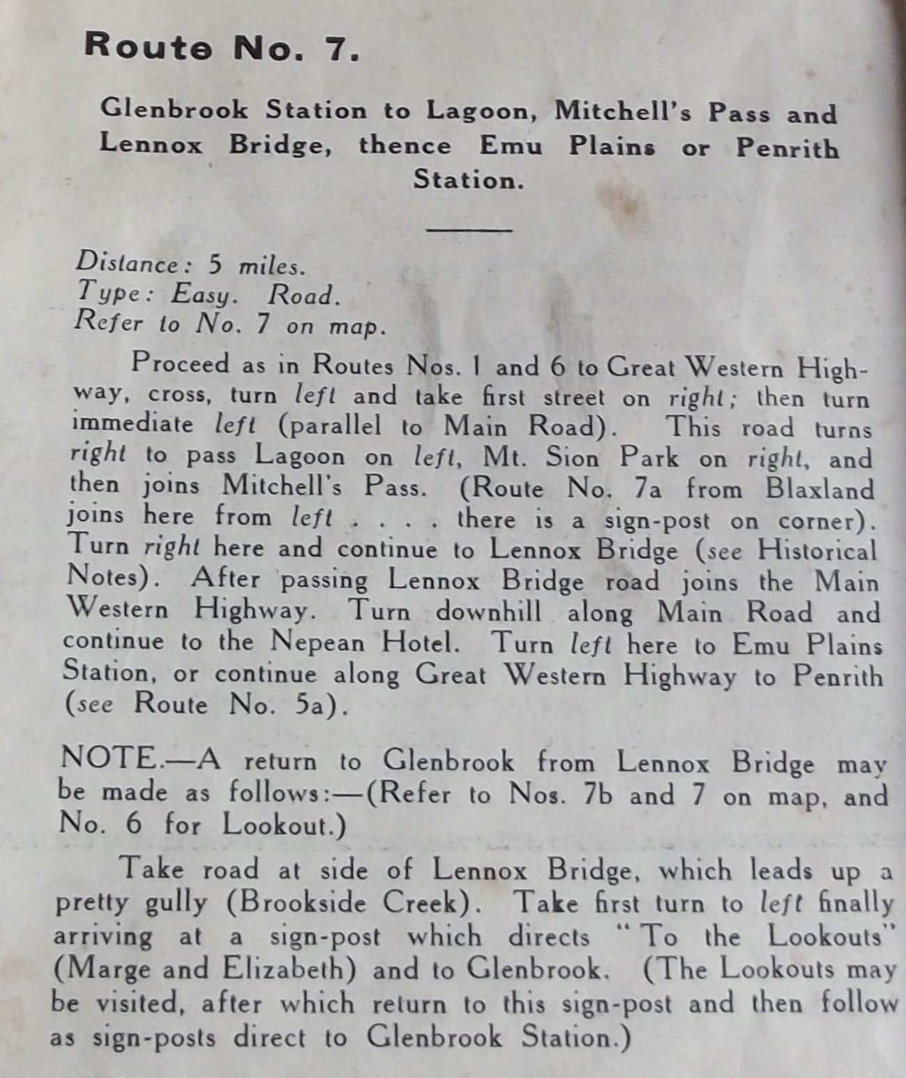
1938 MAP (Part 7) Mitchell's Pass Area (Glenbrook and Blaxland)

1938 MAP (Part 7) Mitchell's Pass Area (Glenbrook and Blaxland)

This walk has access points at both Glenbrook and Blaxland stations and finishing points at Emu Plains and Penrith stations. On the map it is shown as Route 7 along with 7a, 7b and 7c. 
With all the suburban development taking place in this area, a road walk of this length would not be as pleasant as it must have been in 1938. Nevertheless, given the history of the place and the presence of one of Australia's most historic bridges, it still has a lot to offer the informed walker. A good alternative would be to design your own route from Blaxland station to Lennox bridge, returning via Glenbrook station.


Relevant videos: Lennox Bridge


Sunday, 5 May 2019

1938 MARGE'S AND ELIZABETH LOOKOUTS (Part 6)

1938  MARGE'S AND ELIZABETH LOOKOUTS (Part 6)

This map segment covers the area from Glenbrook station to the the Lapstone escarpment overlooking the Nepean River and Penrith.
Here you will come across evidence of the difficulties that both road and railway engineers found in coping with the sudden rise from Emu Plains to Glenbrook. The notes accompanying the 1938 maps don't have much to say on the subject so I have given a few links to sites which will fill in the gaps.
You should use a modern street directory and walks guide book before tackling this walk.


Wednesday, 1 May 2019

1938 MAP (Part 5): GLENBROOK GORGE AND THE NEPEAN RIVER

1938 MAP (Part 5): GLENBROOK GORGE AND THE NEPEAN RIVER

These 2 walks (5 and 5a) expose several problems facing conservation and recreational tourism. I won't enlarge on them but any time you spend in thinking about them will be time well spent. Obviously there are many other related issues which the modern world must face.
Access to and through private land. This goes back to Victorian times in the UK but it's still on the agenda in the Blue Mountains.
Keeping areas "wild" when all around are development pressures.
Preserving relics of the past in an environment where growth is seen as essential.
The visitor to Lapstone and Glenbrook is confronted by active geology, though what looks recent may in fact have happened millions of years ago. The publication "Layers of Time" (2001) will help you understand this area better. You can download a copy at no charge here.
Here are some relevant videos: "Glenbrook Gorge" (David Noble), "3642 + 3526 In Glenbrook Gorge with Caves Express" (Nosecone Oz), "Blue Mountains Flight" (Mick Turner Aerials) .


Saturday, 27 April 2019

1938 MAP (PART 4) RED HANDS CAVE GLENBROOK

1938 MAP (PART 4) RED HANDS CAVE GLENBROOK

The Red Hands Cave at Glenbrook is one of the most accessible indigenous art sites in the Sydney district. Please respect it. A good starting point is this National Parks website here.
See also this video by Chris Osborne here.


Thursday, 25 April 2019

1938 MAP (PART 3) BLUE POOL GLENBROOK CREEK

1938 MAP (PART 3) BLUE POOL GLENBROOK CREEK

This walk includes what is now the main vehicle access point into the Glenbrook section of the Blue Mountains National Park. You will definitely need a current street directory and modern walks guide book. A lot has changed since 1938.

Here is a link to a "Wildwalks" map and information site.  


Here is a link to a video by Yoshisaurus Rex of a visit to the Blue Pool.

Since Route 3 is near enough the same as Route 2, here is the information on it, to help your planning

Monday, 22 April 2019

1938 MAP AND WALKS INFORMATION (PART 2): THE BLUFF LOOKOUT GLENBROOK

1938 MAP AND WALKS INFORMATION (PART 2). THE BLUFF LOOKOUT GLENBROOK


You are strongly recommended to consult a modern street directory and to consult a current guide book to the Blue Mountains.
This link will take you to a short video (by pincbit) taken at the Bluff Lookout Glenbrook .