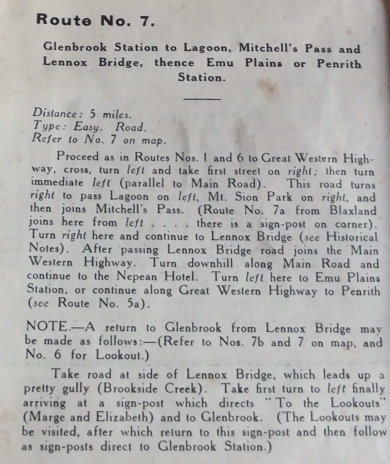
This walk has access points at both Glenbrook and Blaxland stations and finishing points at Emu Plains and Penrith stations. On the map it is shown as Route 7 along with 7a, 7b and 7c.
With all the suburban development taking place in this area, a road walk of this length would not be as pleasant as it must have been in 1938. Nevertheless, given the history of the place and the presence of one of Australia's most historic bridges, it still has a lot to offer the informed walker. A good alternative would be to design your own route from Blaxland station to Lennox bridge, returning via Glenbrook station.


Relevant videos: Lennox Bridge
Notes on the history of Mitchell's Pass
https://johnsbluemountainsblog.blogspot.com/2013/12/links-to-all-blog-entries-and-relevant.html All Blue Mountains blogs and videos
All New England and other Geology blogs and videos
Limestone Caves of NSW
Song Studies. Bible studies based on hymns and songs
Shoalhaven District Geology
No comments:
Post a Comment