Search This Blog

Tuesday, 25 June 2019

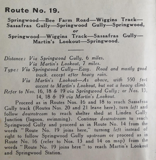
1938 MAP (PART 18): SPRINGWOOD - BEE FARM ROAD - WIGGINS TRACK - SASSAFRAS AVENUE - SPRINGWOOD-

1938 MAP (PART 18): SPRINGWOOD - BEE FARM ROAD - WIGGINS TRACK - SASSAFRAS AVENUE - SPRINGWOOD-

There is no Part 17 as the material is included in other parts. Once again, you will need to check out a modern map and guide book to be sure of being on the right tracks, if you plan to walk in this area.
Here are a few links which will take you information about the area.

Short video on Sassafras Gully: https://www.youtube.com/watch?v=8ToYouJtWJ4


Thursday, 20 June 2019

1938 MAP (PART 16): SPRINGWOOD - SPRINGWOOD GULLY - SASSAFRAS GULLY - MARTIN'S LOOKOUT - SPRINGWOOD

1938 MAP (PART 16): SPRINGWOOD - SPRINGWOOD GULLY - SASSAFRAS GULLY - MARTIN'S LOOKOUT - SPRINGWOOD

The information for this walk is clearly indicated on the map below; much of the content is the same as that given for previous walks.


Friday, 14 June 2019

19MAP (PART 15): SPRINGWOOD - MARTIN'S LOOKOUT -- SASSAFRAS GULLY - SASSAFRAS AVENUE - SPRINGWOOD38

1938 MAP (PART 15): SPRINGWOOD - MARTIN'S LOOKOUT -- SASSAFRAS GULLY - SASSAFRAS AVENUE - SPRINGWOOD

Here's another walk which takes you down into the valley of Glenbrook Creek and its tributaries. The people of Springwood are blessed in having many fine walks so close to town. In 1938, most walkers would have arrived by train, which is why the walk descriptions always commence at a railway station.
To make sense of the description, you may need to refer to the previous walks' information.


If you are considering doing this walk, don't begin without taking a modern map and information.
This Wild Walks information should be very helpful. here.


Wednesday, 5 June 2019

1938 MAP (PART 14): SPRINGWOOD - MARTIN'S LOOKOUT - PERCH PONDS - SPRINGWOOD GULLY

1938 MAP (PART 14): SPRINGWOOD - MARTIN'S LOOKOUT - PERCH PONDS - SPRINGWOOD GULLY

The name "Springwood Gully" is shown on this map but I can't find it using the Google search engine. I'm pretty sure it is the place we know today as "Magdala Gully".
Modern maps show many more place names than the 1938 one does, as well as more tracks. A modern guidebook such as Veechi Stuart's "Blue Mountains Best Bushwalks" will help you identify locations.
If you are searching for the route number on the map (14) it is at the bottom above the "k" of "Glenbrook".


Assuming that Magdala Gully and Springwood Gully are one and the same, the latter part of this account of a walk by the Mt Wilson Mt Irvine Bushwalking Group will tell you quite a bit about the place. here.

Tuesday, 4 June 2019

1938 MAP (PART 13): SPRINGWOOD TO MARTIN'S LOOKOUT

1938 MAP (PART 13): SPRINGWOOD TO MARTIN'S LOOKOUT

The walk as described in 1938 basically follows roads. While Martin's Lookout itself is well worth visiting, most people today would be more interested in the tracks which start there and use the route described as an access only.


Is the name "Echo Point" still used for this place? You can see it on the map just to the left of the words "Martin's Lookout".
Here is a video (drone footage) made at the lookout. here.
Lyre bird singing near Martin's Lookout. here
Most YouTube videos are about the track from Martin's Lookout to Lost World Lookout.